
Short answer: Hallasan is worth visiting, but “doing Hallasan” does not require a Baengnokdam summit. Divide the choice into SUMMIT for Baengnokdam, RIDGE for Witse Oreum and the high plateau, and SHORT for a smaller forest-and-mountain experience. A Seongpanak round trip consumes most of a day; Eorimok or Yeongsil can deliver open mountain scenery in half a day; Eoseungsaengak suits a traveller with only a few hours. A reservation QR proves eligibility for a controlled summit section. It does not guarantee weather, crater views, parking or physical completion. Choose the intended experience first, then verify live controls, transport, daylight and turnaround time.
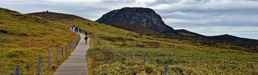
- SUMMIT: To stand at Baengnokdam’s east-ridge summit, reserve 9–11 hours. Under normal operation, the controlled upper sections are approached through Seongpanak or Gwaneumsa; recheck the live restriction before departure.
- RIDGE: If highland views matter more than summit proof, take Yeongsil or Eorimok toward Witse Oreum. The Baengnokdam summit reservation is not required, but seasonal checkpoints and weather controls still apply.
- SHORT: When fitness differs across the group, the day starts late, or you only want a mountain introduction, consider Eoseungsaengak or another short trail instead of turning half a day into a failed summit attempt.
- Lowest-risk version: Prepare water, food, footwear, warm layers and offline maps the night before. Check official live status and CCTV in the morning; if any safety gate fails, switch to a shorter trail or a lowland plan.
Is Hallasan one attraction—or an entire trail system?
Hallasan is the national park and volcanic highland at the centre of Jeju, not a viewpoint where a car stops beside one entrance. Different trailheads lead toward Baengnokdam, Witse Oreum, the south wall, forest, volcanic cliffs or short subsidiary peaks. Round trips range from a brief mountain walk to almost 20 kilometres.
Typing “Hallasan” into a map therefore does not create a destination. Choose a trailhead before arranging transport. Reaching the wrong entrance can invalidate the planned QR checkpoint, miss a seasonal cutoff, or leave the group finishing far from the parked car.
Is Hallasan worth a full day on a first Jeju trip?
Yes if you enjoy hiking, volcanic landscapes or a full-day physical experience. Its scale differs completely from Jeju’s coast, cafés and indoor attractions. Baengnokdam is not the only return: changing forest zones, high plateaus, clouds and weather become part of the day.
If the trip has only three days, the group does not hike, or Seongsan, Udo and the coast matter more, do not surrender a whole day merely because Hallasan is Korea’s highest mountain. Put complete days into a three-day Jeju itinerary first and see what the mountain would displace.
Why separate SUMMIT, RIDGE and SHORT?
SUMMIT centres on Baengnokdam and a full endurance challenge. RIDGE seeks Witse Oreum, the plateau and south-wall scenery. SHORT asks only for a safe introduction to Hallasan’s forest and altitude. Each objective needs different reservations, time, transport and equipment.
The common mistake is ranking them as success, second best and failure. When cloud hides Baengnokdam, an open Yeongsil ridge can produce more visual return than many hours inside the forest. A mixed-ability group completing a short route safely is also more complete than racing a checkpoint.
Which two trails can reach Baengnokdam?
During normal operation, only Seongpanak and Gwaneumsa lead to the east-ridge summit overlooking Baengnokdam. The official Seongpanak distance is 9.6 kilometres one way with an estimated 4.5 hours. Gwaneumsa is 8.7 kilometres one way with an estimate of about five hours. These are planning references, not personal guarantees.
Eorimok, Yeongsil and Donnaeko do not continue to the Baengnokdam summit. Treating every “Hallasan trail” as a route to the same finish creates the wrong expectation. A summit day begins with a reservation and full-day fitness; a traveller who does not need the top gains more freedom.
Is a Hallasan summit just an ordinary hike?
No. A Seongpanak out-and-back is about 19.2 kilometres. Although much of its grade is more even than Gwaneumsa, distance, stone surfaces, altitude, descent fatigue and weather accumulate. Gwaneumsa is slightly shorter but has greater elevation change and steeper sections. The park recommends lower routes reaching roughly 1,700 metres for people without recent hiking experience or with relevant health conditions.
Do not shrink the official estimate with a flat-city walking pace. Rest, QR checks, toilets, food, photographs, ice and wet footing all add time. The real time block begins when the traveller leaves the accommodation and ends after a safe return to town.
Should you choose Seongpanak or Gwaneumsa?
Seongpanak is longer with a more evenly distributed climb and extensive forest, suiting someone who prefers a steady rhythm. Gwaneumsa is steeper with more dramatic valleys and terrain, but gives knees, footing and weather less tolerance. Distance alone does not define difficulty.
The classic Seongpanak-up, Gwaneumsa-down crossing can show both landscapes, but the trailheads do not share a car park. Retrieval or transfer must be solved first. If transport is not fixed, returning by the same route is safer than choosing a new exit at the summit.
What happened to Gwaneumsa in August and September 2026?
A Hallasan National Park notice dated June 19, 2026 states that the Gwaneumsa section from Samgakbong to Baengnokdam is restricted from August 1 through September 30, 2026 while damaged rockfall protection and hazardous decking are repaired. During the notice period, Baengnokdam can be reached only through Seongpanak.
The Gwaneumsa entrance-to-Samgakbong section remains available as a non-reservation hike, but “open to Samgakbong” does not mean it connects to the summit. This is a dated current restriction, not a permanent rule. Travellers after September must still read the official live page instead of relying on this article or an old video.
Which sections does the current reservation system control?
After the 2025 adjustment, the reservation operation covers the upper Azalea Field–Baengnokdam section on Seongpanak and Samgakbong–Baengnokdam on Gwaneumsa. Eorimok, Yeongsil, Donnaeko, Seokguram and Eoseungsaengak do not require this summit reservation.
A lower section being reservation-free does not remove every control. Trails still have seasonal entry and descent checkpoints, and heavy rain, typhoons, snow or construction can trigger partial or full closure. Capacity and safe operation are separate gates.
When do reservations for the next month open?
The current official guide opens reservations at 09:00 on the first working day of the preceding month. If the first falls on a weekend or public holiday, opening moves to the next working day. One person can reserve for up to four people at once, and popular weekends, foliage, snow and sunrise dates can fill quickly.
Do not wait until flights, hotels and a car are non-refundable before checking capacity. Place a mountain day and one exchangeable backup day in the itinerary, then reserve on opening day. If capacity is gone, switch to Yeongsil or Eorimok rather than buying a QR from an unknown seller.
What matters about QR codes, identification and no-shows?
The park requires an individual QR for each reserved visitor and may check identification at entry. QRs arrive through the message or email method used during reservation. Verify each traveller’s name and document before departure instead of storing one group screenshot only on the leader’s phone.
If the hike cannot happen, cancel before the reserved entry window ends. Current rules attach restrictions to no-shows and prohibit QR trading. Bad weather without an automatic official cancellation is not permission to ignore the booking; log in through the original authentication method and process the cancellation.
Who is Seongpanak best for?
Seongpanak starts around 750 metres above sea level and passes Sokbat, the Sara Oreum junction and Azalea Field before Baengnokdam. The official listing gives 9.6 kilometres and about 4.5 hours one way. Much of the trail below the summit sits in forest, so views are not continuously open.
It suits someone who can sustain a long walk and understands that “more gradual” still means very long. Adding Sara Oreum requires extra distance and time and should not be automatic. If the group reaches Azalea Field too late for its checkpoint, follow staff instructions and turn back.
Who is Gwaneumsa best for?
Under normal full operation, Gwaneumsa covers 8.7 kilometres one way and takes about five hours officially, climbing from the campground area through Tamna Valley and Samgakbong Shelter into steep high terrain. Its landscape is more dramatic, but the physical and downhill demands are greater.
It is not easier because it is shorter than Seongpanak. Consider it only with recent long-hike experience, stable knees and ankles, solved transport and confirmed opening. During the August–September 2026 upper restriction, old full-route footage is not evidence that the summit section is passable.
Why is Yeongsil often underestimated?
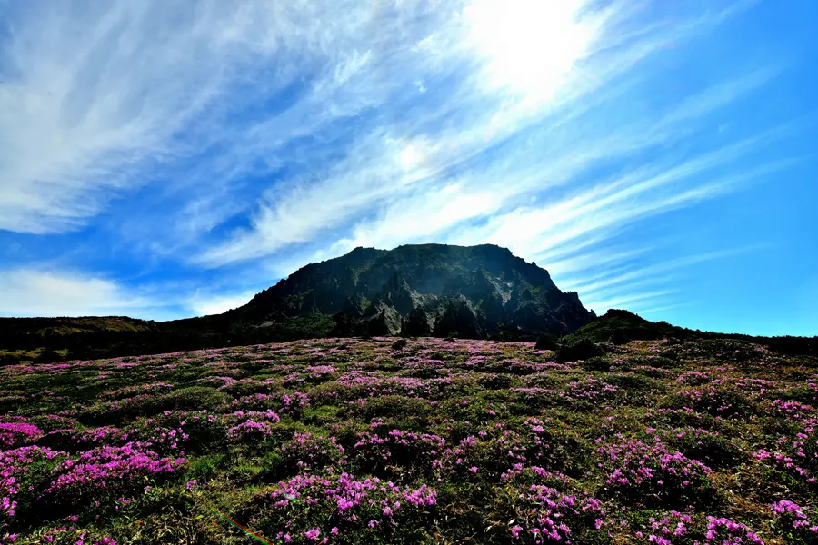
Yeongsil climbs past volcanic cliffs and forest into the highland. The official route is about 3.7 kilometres from Yeongsil to Witse Oreum and can extend to the south-wall junction, with the full listing at 5.8 kilometres. Apart from the steeper Yeongsil crater-ridge section, the plateau is comparatively level and concentrates its visual return.
It cannot reach Baengnokdam, but it is a strong first-Hallasan choice for a traveller who values scenery over a certificate. Distinguish the lower Yeongsil management area from the higher trail start. Road access, parking and transfer conditions can change where the walk actually begins.
Who should choose Eorimok?
The official Eorimok route is 6.8 kilometres through Eorimok Valley, Sajebi Hill, Manse Hill, Witse Oreum and the south-wall junction, with an estimated three hours one way for the full line. The early climb needs effort, while the higher terrain becomes more open.
It also does not reach Baengnokdam. Do not arrive casually in the afternoon merely because no summit reservation is needed. Entry, Witse Oreum and south-wall directions have time controls. Even an out-and-back only to Witse Oreum needs descent and bus-wait time.
Can you go up Yeongsil and down Eorimok?
When the trails and checkpoints are open, Yeongsil and Eorimok can connect through Witse Oreum to make a traverse, avoiding a complete retrace and showing different terrain. The trailheads, however, are separate and a private car remains at one end.
The decisive problem is transport, not the line on a map. Verify bus schedules, walking from stops, the Yeongsil access road and phone signal for pickup. Without a reliable transfer, returning to the parked vehicle is more robust than inventing a solution after descent.
With only two or three hours, is Eoseungsaengak more sensible?
Yes. Eoseungsaengak is one of the park’s shorter options and suits mixed fitness, a late start or someone wanting only a mountain introduction. It does not replicate the Baengnokdam summit, but it can provide forest, altitude and fast-changing mountain weather with a lower commitment.
Short does not mean risk-free. The trail still has a final entry time, and rain, ice and strong wind remain possible. If a companion is uncomfortable even on a short climb, choose a lowland viewpoint instead of using “it is very short” as pressure.
Is Donnaeko a good first Hallasan hike?
Donnaeko approaches the south-wall junction through southern forest. Official material gives roughly seven kilometres one way and about 3.5 hours, so it is not a short route. Its appeal is forest and a southern approach; its tradeoff is no direct Baengnokdam summit and separate transport planning.
With only one first visit, choosing between a Seongpanak summit and a Yeongsil/Eorimok scenic day is easier to evaluate. Donnaeko fits a traveller who specifically wants a long forest route and can meet its earlier checkpoints, not someone seeking an unreserved casual fallback.
Why do seasonal checkpoints matter more than the walking estimate?
The park uses seasonal controls at entrances, Azalea Field, Samgakbong, Witse Oreum and the south-wall junction so day hikers can finish before sunset. Official pages can retain different seasonal-table versions, so this guide does not freeze one timetable as a permanent promise.
Check the visit date, exact trail and live control rather than only asking when the entrance opens. Reaching the first gate does not permit continuation after a middle checkpoint closes. Turning around is part of the trail system, not proof that the day failed.
What time should a hike begin?
For a summit, prefer the earliest workable reservation window to protect margin for weather, rest and descent. From December 2025, official summit windows were consolidated into 05:00–08:00 and 08:01 to the applicable late-entry control. The reservation screen for the actual date is authoritative.
Being allowed into the final window does not make it the best choice. A later long-route start leaves fewer options for cramps, slippery footing, fog or transport delay. Half-day Yeongsil and Eorimok hikes should also begin earlier than the bare minimum so descent and waiting remain in daylight.
Will Baengnokdam always contain water and be visible?
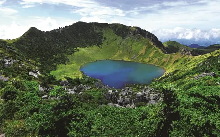
No. Crater water, cloud, fog, wind and season can make the view completely different from promotional photographs. Clear weather in Jeju City does not guarantee a clear summit. A reservation secures a capacity slot, not visibility.
Define success as safely completing the chosen trail rather than obtaining an unobstructed crater photograph. If only a cloudless Baengnokdam is acceptable, the disappointment risk is high. If forest, terrain and physical experience have value, imperfect weather can still produce a worthwhile day.
Which three live checks matter on the morning?
First, read the official trail status for full opening, partial control or closure. Second, check mountain weather and live CCTV instead of a city-only forecast. Third, recheck transport, trailhead and parking. If one of these gates fails, recalculate the route.
A screenshot saying “normal operation” the previous night is insufficient. Wind, heavy rain, snow and emergency work can change status in the morning. Preserve data access and offline backups; the Jeju driving and eSIM preparation guide helps save official pages, maps and emergency contacts.
Can you hike Hallasan in rain?
Light rain does not automatically close every route, but stone, boardwalk and roots become more slippery and fog reduces visibility. Do not enter during heavy-rain warnings, typhoons or official closure. A rain jacket handles water; it does not remove rockfall, lightning or wind-chill risk.
When the mountain is the only immovable day in the trip, travellers become more likely to force a poor decision. Prepare a Jeju rainy-day fallback and place the mountain between two exchangeable days so moving it remains easy.
What changes for a winter Hallasan hike?
Winter brings ice, snow, strong wind, cold and shorter daylight. Official guidance specifically calls for winter clothing, crampons, gloves, warm water and spare layers. A patterned sole does not replace suitable traction when ice is present. Missing equipment cannot be repaired with determination.
Snow scenery is attractive, but rented equipment does not create winter-mountain experience. Use the Jeju winter-nature accommodation decision to secure dawn transport and a backup day. When official requirements or live conditions exceed ability, switch to a short trail or lowland snow view.
In summer, is sun protection and extra water enough?
Summer also brings heat, humidity, dehydration, afternoon convection, thunderstorms and insects. Long forest coverage on Seongpanak does not guarantee cool conditions. Sweat-soaked clothing can then become cold when wind rises on the high ground.
Carry sufficient water, electrolytes and immediately edible food, and consume them gradually rather than waiting for severe thirst. Sun protection, a hat, rain layer and dry clothing belong together. Under a heat warning or thunderstorm forecast, shortening the route matters more than preserving a timetable.
What standard of shoes, clothing and backpack is needed?
A long route needs stable, broken-in footwear with useful grip, layered clothing and a wind-rain shell, with hat, gloves and seasonal additions. New shoes opened that morning, flat fashion footwear and a disposable poncho alone can magnify otherwise manageable discomfort.
The pack should not be needlessly heavy, but it needs water, food, warmth, basic first aid, charging, identification and a rubbish bag. Trekking poles can reduce some descent load but do not replace fitness or careful foot placement. Test every new item before the mountain day.
Are there shops, water and toilets on the trail?
The official Seongpanak information explicitly lists no shop on the trail. Food, drinking water, rain protection and winter traction must be prepared before departure. A shelter is not a restaurant, and a hiker should not assume drinking-water refill. Toilets appear only at named entrances and shelter points.
A closed breakfast venue or convenience store far from the trailhead is a common dawn failure. Buy food the night before that will not leak and remains edible when cold or tired, then carry its packaging down. Do not cook in prohibited areas or depend on another hiker’s water.
Is a rental car always the easiest option?
A car gives control over dawn departure, equipment and the return to accommodation, but parking scarcity, separate trailheads and fatigued driving remain costs. The park specifically warns that Seongpanak parking is limited and can fill very early. Having a car does not create a space.
Use the Jeju rental-car decision guide to count the driver, snow ability and condition after descent. On a traverse, the vehicle stranded at the start creates another problem. A prearranged driver or transfer can be more rational than rental.
Can you hike Hallasan without a car?
Yes, but research the exact trailhead rather than searching only for a “Hallasan bus.” Seongpanak is approached along the 516-road corridor; Gwaneumsa usually involves a transfer; Yeongsil and Eorimok have their own stops and service patterns. The first arrival must precede the required entry window.
Use the Jeju bus travel guide to verify the outbound trip, final return and the walk from the stop. A descent 30 minutes slower can miss a bus with a long interval. Save a taxi contact and a clear lowland waiting point as Plan B.
How should parking, taxis and cross-trail transfers work?
Confirm the intended trailhead before driving. The park office address is not a universal car park for every route. Seongpanak has tight capacity; Gwaneumsa, Eorimok and Yeongsil each have their own roads and parking constraints. Expect earlier saturation on weekends, snow days and foliage dates.
For a taxi ascent, show the driver the Korean trailhead name and exact map point. A descent pickup needs signal, an agreed waiting area and a driver willing to climb the road. A Seongpanak-up, Gwaneumsa-down plan requires transport before departure, not an improvised booking from the summit.
Is Jeju City or Seogwipo the better base?
The answer follows the trailhead, not a belief that every base is equal because Hallasan lies in the centre. Seongpanak can be approached along the 516 corridor from either side; Gwaneumsa is north; Yeongsil and Eorimok sit around the 1100-road side. Dawn movement matters more than straight-line distance.
Use the where-to-stay guide for a Hallasan hike to fix the trailhead night, then the Jeju accommodation-area decision for the rest of the trip. Moving hotel for one mountain day may not help, but two central or north-south route days can reduce backtracking.
Should children, older travellers or people with health conditions summit?
Age alone cannot answer. Consider recent long walks, knees, ankles, heart and lung capacity, balance, medication and response to cold. The official Gwaneumsa page also warns about health risk at altitude and recommends lower Eorimok or Yeongsil options for people without recent hiking experience or with relevant conditions.
A child walking a long distance does not prove safe descent after fatigue; an active older traveller does not automatically tolerate ice. Plan around the slowest and most support-dependent companion. A group unable to accept a midpoint turnaround should not start the long route.
Can you hike Hallasan alone?
Popular sections often have people, but that does not remove solo risk. Give the route, expected times and check-in deadline to the accommodation or a trusted person. Carry a charged phone and power bank, and do not leave the marked trail to chase a view or avoid crowds.
For injury or disorientation, call 119 or the park office and read the nearest trail-location marker. Attaching yourself to strangers while exhausted is not a safety system. Turn around while independent movement remains possible when something feels wrong.
Can you camp, cook or remove stones inside the national park?
Camping and cooking are prohibited outside the designated Gwaneumsa campground. Plants, insects, soil and rocks must stay in the park. Remain on designated trails, take all rubbish out and avoid disposable meal boxes that create unnecessary mountain waste.
An unwatched barrier is not permission to cross it for a photograph. Highland vegetation recovers slowly, and one side track encourages others. No image justifies damaging a protected area. Do not feed wildlife or leave food remains at a shelter.
Is a summit certificate worth special planning?
A certificate suits someone who values a completion record, but it must never become a reason to continue in unsafe conditions. The official application requires a summit photograph taken on the climbing date. After approval and payment, the certificate is printed at a trailhead kiosk.
Check the latest application process, image format, deadline and kiosk location before departure. A dead phone, a photograph without matching date information or remembering only after leaving can affect issuance. The certificate is an optional record after completion, not the centre of the safety decision.
What does a lower-risk Seongpanak summit day look like?
Night before: prepare QR codes, identification, water, food, clothing and transport. Early morning: check official live status, CCTV and weather, then enter within the reservation window. Middle: evaluate time and the body before the Azalea Field cutoff; turn around for any serious warning.
Summit: leave by the official latest descent instruction and do not delay indefinitely for cloud to clear. Descent: preserve knees and daylight, then handle certificates, transport and dinner at the entrance. Do not automatically add Udo, a sunset coast or a long night drive.
Fifteen checks before departure
- Choose SUMMIT, RIDGE or SHORT first.
- Confirm the exact trailhead and Korean name.
- For a summit, verify the controlled-section reservation.
- Give every traveller an individual QR and identification.
- Read the same-day official trail status.
- Check mountain CCTV and weather warnings.
- Confirm entrance, midpoint and descent cutoffs.
- Calculate the entire return, not only the ascent.
- Verify the first outbound and last return transport.
- With a car, prepare for a full car park.
- Wear tested footwear with reliable grip.
- Carry rain, warmth or traction for the season.
- Bring sufficient water, food and backup power.
- Share the route and check-in time with someone.
- Accept a hidden crater and a midpoint turnaround.
If one answer is missing, the entire day does not have to disappear. Move from SUMMIT to RIDGE and then to SHORT. The dangerous response is treating every failed condition as mandatory because the capacity, hotel or car has already been paid.
Repeat the check after starting. Foot pain, dizziness, falling pace, worsening sky, soaked layers or a missed checkpoint can all change the answer. A hiking plan is not a contract; returning safely to the trailhead is completion.
Final verdict: which Hallasan day is worth it?
Worth summiting: recent endurance, an early capacity slot, complete equipment, reliable transport and an exchangeable backup day. Most balanced: choose Yeongsil or Eorimok toward Witse Oreum when highland scenery matters more than a certificate. Short and complete: use Eoseungsaengak when group ability varies.
Do not force it: rain, snow or wind control; missing food or equipment; a late start for a long route; unsolved parking or return transport; or the belief that every Jeju visitor must summit. Hallasan rewards choosing the right height for the conditions, not proving fitness during one holiday.
Sources and update note
Checked August 23, 2026. Reservation sections, capacity, entry and descent cutoffs, Gwaneumsa construction, parking, buses, certificates and trail opening can change. Recheck the official live page both the night before and on the morning of the hike.